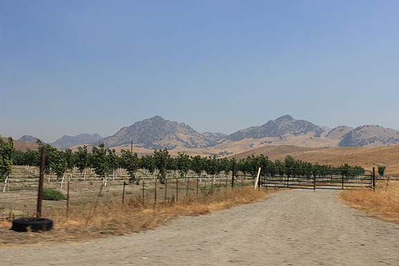
North of Sutter Buttes the area is filled with almond orchards, which though very parched seem to be doing ok.
I’m relatively new to the enormous body of work covering the history, politics, and geography of water in California. Given the severe drought gripping most of the state (great 8-second animation here), and the oft-repeated cliché that water is the oil of the 21st century, it seems like a good time to start paying closer attention! I decided, after some research, to go and have a look, taking the opportunity that most of us fog-bound San Franciscans do to escape to the searing heat of the Central Valley at least once during the cool, windy summer we get here on the coast (though to be honest, this year has been relatively warm and sunny until the last few days). Adriana and I borrowed a car and rode along levees from the mouth of the Sacramento River at the edge of the once-enormous Delta, all the way to Sacramento (only pausing there to visit “Old Sacramento” which I had somehow never done), and then back on to the levees north toward our first night’s destination of Marysville at the conjunction of the Feather and Yuba Rivers.
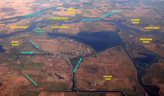
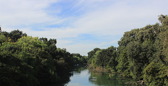
Here’s a view of the Delta I took from a plane in September 2013.
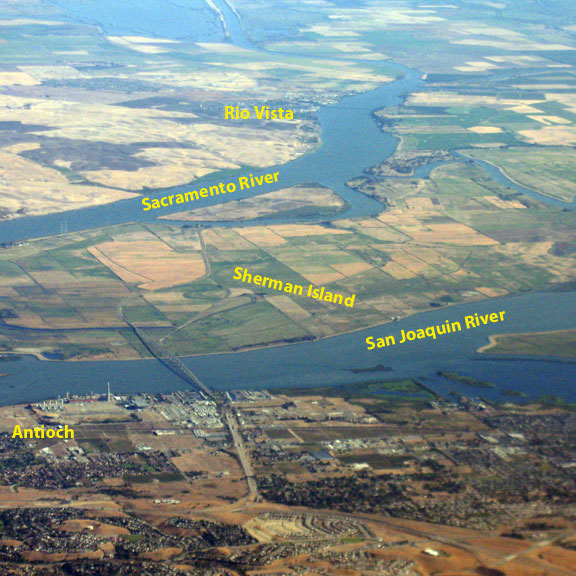
We went to Rio Vista on our first stop, crossing onto Sherman Island at bottom left of image on the Antioch bridge before crossing the Sacramento River into Rio Vista.
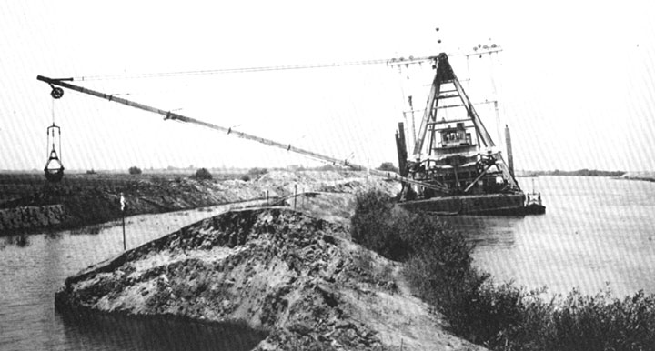
I’ve been giving myself a crash course during the summer, in preparation for teaching a new class at the SF Art Institute called “Dredge.” One of the unusual finds I made was the Dutra Museum of Dredging in Rio Vista, at the edge of the Montezuma Hills, a old geologic formation that forces the Sacramento River around it south in its path through the Delta to the Bay. The folks behind the museum are an old family-run California dredging company, and they’ve published a beautiful book “The Tule Breakers,” which is an exhaustive history of their industry, and includes a general overview of the terrain and conditions in which their business has been conducted.
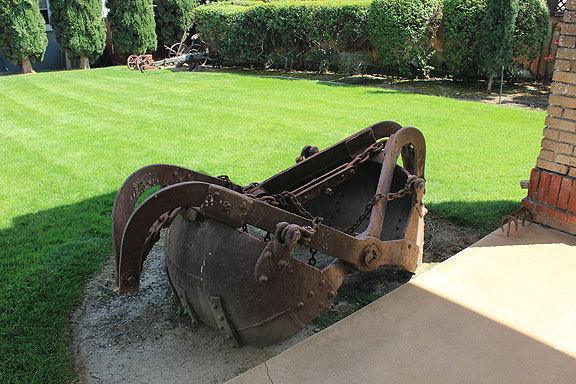
One of the rusting dredges on the grounds of the Dutra Museum of Dredging in Rio Vista.
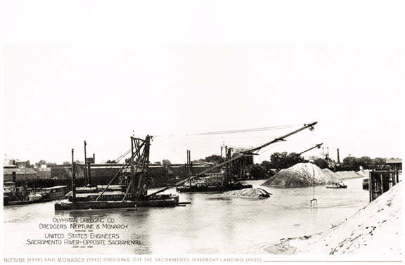
In this 1930 image from “The Tule Breakers” you can see the dredges working to excavate sand and mining debris (still flowing down from the Gold Rush days) from the channel of the Sacramento River.
I also read Battling the Inland Sea by Robert Kelley, a fascinating account of the politics of water and rivers in California in the 19th century. Kelley goes through the saga chronologically to show how the Democrats who dominated state politics after the Civil War were the standard-bearers of laissez-faire individualism. They were opposed by the Republicans, who carried on the politics of the defunct Whig Party in favor of a more centralizing and coordinating role for government. In a nutshell, the two parties in the 19th century held reversed positions compared to today. The Republicans were the party in favor of publicly funded infrastructure which would improve conditions broadly for “everyone.” Read in a more class conscious way, we would say they were the party of Capital in its broadest interests, while the Democrats tended to defend the interests of individual property owners against encroachment by the state, seeing the individual owners as the logical descendants of a Jeffersonian agrarian democracy and the state as beholden to the interests of the monied interests and large corporations that were emerging in the late 19th century. The Democrats were also more brazenly the party of white supremacy, although it must be admitted that racist ideology was the norm across the political spectrum until well into the 20th century.
The domination of laissez-faire inspired localism led to a decades-long failure to assess California’s hydrological reality in systemic terms. Instead of looking at the interlocking river system as a whole, and seeing the entire Sacramento Valley (the northern part of the Central Valley) as an integrated watershed draining a dozen rivers eventually into the Delta and Bay, each individual farmer and landowner was encouraged to take individual responsibility for building levees to protect their property. This led to a kind of “arms race” as one would build levees to a certain height, forcing the landowner across the river to build a bit higher, that would in turn force the original owner to build his even higher, and so on. It was exacerbated by the fact that county lines often ran down the middle of rivers (e.g. the split between Marysville in Yuba County and across the Feather River sat Yuba City in Sutter County), so property owners would also have different local governments from which to seek legal remedy or support. The first legal entities formed in California beyond the elected legislature and local governments were “reclamation districts” who gained the right to tax property and even seize it under eminent domain if needed to execute plans for water channeling and farmland protection. These entities were dominated by land speculators who often used their political power, not surprisingly, to direct Reclamation Districts to projects benefiting their landholdings.
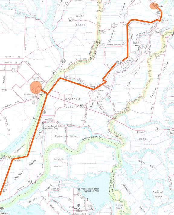
The first leg of our road trip on the levees (going from lower left to upper right). The two circles are Rio Vista at left, and Locke at upper right.
In one example, during the late 1860s various speculators began to buy swamplands along the Sacramento River and hired Chinese labor to build dikes and levees to drain the fields to grow wheat, leading to a very profitable period of years in which hyper-abundant California wheat dominated world markets. The newly productive fields were designated islands (such as Sherman Island) and tracts (such as Holland Tract) and are still present today, though the agricultural fields now are more often used for vineyards and fruit orchards, and the land itself has subsided dozens of feet to lie below sea level, surrounded by massive levees to hold back the Sacramento and San Joaquin rivers and the many sloughs, canals, and other rivers that all converge on the Delta area.
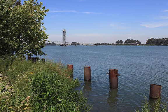
The Helen Madera Bridge across the Sacramento River at Rio Vista (Hwy. 12).
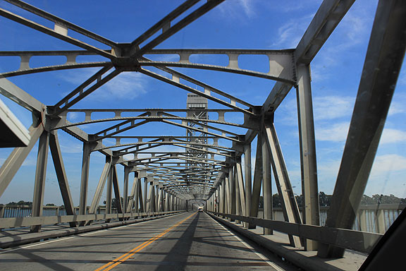
What it’s like on the Madera Bridge… reading about all the thousands of old bridges around the country in need of rehabilitation, I wonder how many of them are in the Delta?
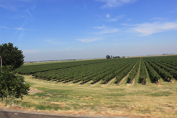
Relatively new vineyards off Highway 12 on Brannan Island.
Grand Island at left, Sacramento River at right, as we roll along the levee heading north towards our next stop in Walnut Grove.
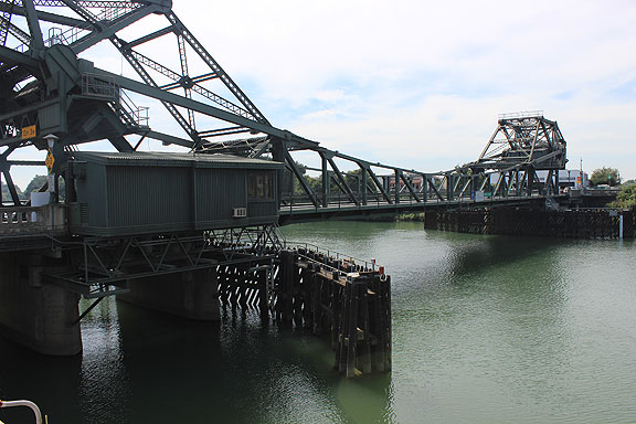
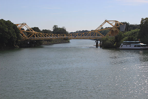
The draw bridge over the Sacramento river into Walnut Grove.
From the levee and draw bridge intersection, Walnut Grove is 20 feet downhill, below sea level.

While riding along these levees, knowing they’ve been rebuilt and improved upon for more than a century, it was impossible not to remember that they had been built originally by Chinese laborers in the 1860s.
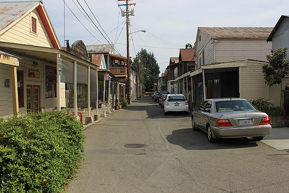
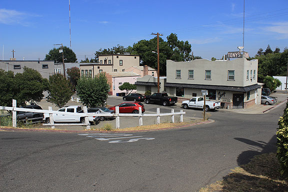
We came to Locke, an amazing relatively intact (though very touristified) town that was once an entirely Chinese community. Somehow the old wooden structures have survived floods and levee breaks for all these decades.
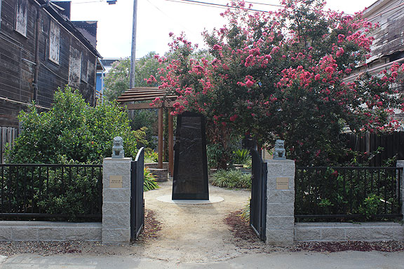
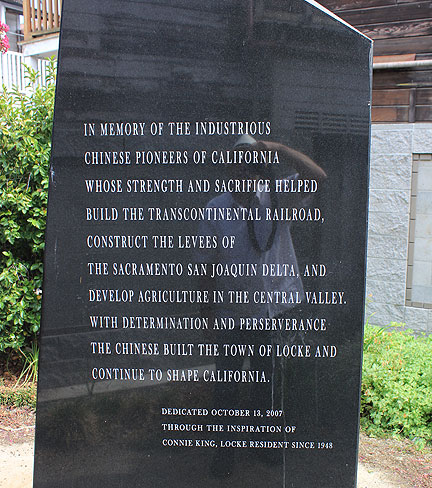
Since the last time I was in town, a new park has been created to honor the Chinese role in the area.
It was also in Locke where we first ran into this “Stop the Tunnels” sign and picked up the information from the local bookstore:
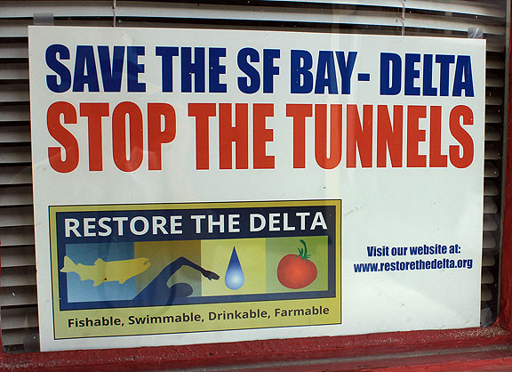
After the successful defeat of the Peripheral Canal in the early 1980s, agribusiness interests and southern California real estate interests have been working tirelessly to figure out another way to get fresh water from the north to the south. The Detla Tunnels are their latest scheme, with the enthusiastic support of Gov. Jerry Brown (ugh).
The technology of river control evolved with the politics. Originally the peat that dominated the lands along the banks of natural levees was dug up and used to build up the height of the levees, but it was soon learned that the peat cracked and dried and also absorbed a lot of water, both qualities making it a poor material for controlling rushing water. Learning that river bottom mud was a much stronger material, the technology of dredging soon took off. With the strong metallurgy and machinist industries of San Francisco already churning out hydrological tools for washing away the mountains in pursuit of gold, it wasn’t hard to get the technical skills directed toward building the equipment needed to mechanize the construction of channels, levees, sloughs, bridges, etc.
Dredging kept getting better, making bigger and bigger machines that could move larger amounts of mud and debris (the rivers being choked with the debris washed down from the watery assault on the gold high above the rivers in the Sierra granite). But the politics of hydrology didn’t keep up until the arrival of the progressive regime of Republican Hiram Johnson in 1911, which also brought in a Republican majority in the state legislature, allowing for a new, centralized approach to California rivers. Arguments over building dams upriver revolved around the purposes such dams should serve—water storage, flood control, power generation, recreation, etc. It was Johnson who responded to the clamor of Sacramento Valley farmers to finally establish a State Board of Reclamation (that odd misnomer that refers to “making land” from wetlands, swamps, and shorelines, by diking and draining them). With this new state regulatory authority, a planning process began that in the decades that followed led to the massive, federally sponsored Central Valley Project in 1933, and a generation later in 1960 the California State Water Project.
And that’s just speaking about the projects that were dedicated to managing the enormous outpouring of waters from the mountains into the Sacramento River valley, controlling flood waters by deepening river channels, raising and widening levees, and designating bypasses, basins, and sinks as permanent flood plains. Upriver on most tributaries dams were built, in some cases to hold back mining debris, but in most to serve the multiple purposes mentioned above. Once captured, the annual rain and snowfall that would rush out of the mountains could be diverted to agricultural irrigation, as well as to water the flourishing suburbanization of California in the last half of the 20th century. There are more famous municipal projects, too, such as the Los Angeles Aqueduct that brought Owens Valley water to LA, or the Hetch Hetchy system bringing water from the Tuolomne river in Yosemite to San Francisco. Massive diversion of Colorado River water to the Imperial Valley for agriculture and to the LA basin for agriculture and suburbanization (and in lesser amounts to Phoenix and Las Vegas), add to the sprawling mega-machine of water capture and delivery that California depends on today.
After stopping at Locke we headed to Sacramento but with a side trip to see the Deep Shipping Channel that allows for heavy shipping into the Port of Sacramento. Unfortunately we headed out Courtland Road but couldn’t get near the Channel, so didn’t get a glimpse of it until we were much further north.
This is a view of Steamboat Slough entering the Sacramento River.
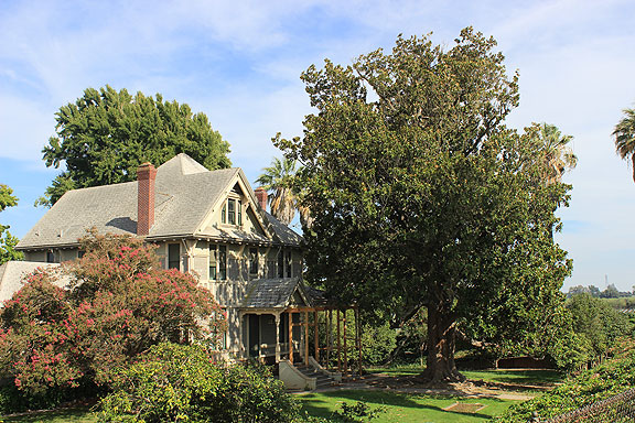
The owner claimed his magnolia was the oldest in the entire Delta… who am I to dispute it?
Elk Slough runs near the Sacramento River, here we are crossing it on Courtland Road.
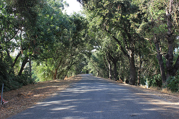
Just past Elk Slough is this turnoff which is a heavily wooded road along the levee. Between levees throughout this area are below-sea-level agricultural fields.
This is the view of Prospect Island where we ran out of road heading to see the Deep Water Channel.
Old pump and irrigation ditch at end of Courtland Road.
We turned around and went back to Hwy 84 which took us straight north into the center of Sacramento by way of an old bridge:
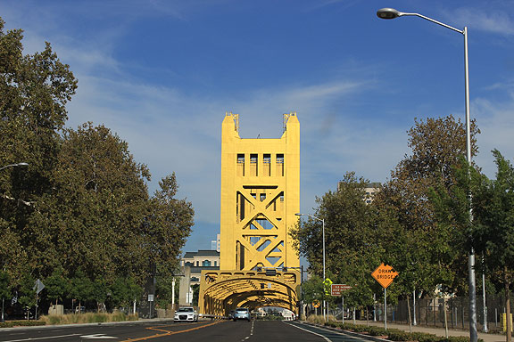
Here is the main road into the center of Sacramento from long before freeways.
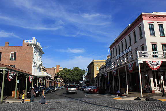
I had never bothered to visit Old Sacramento before, and though it’s a bit like Fisherman’s Wharf, I appreciated the small park where they showed the original level of the town, 9-12 feet below where the City Council mandated every property owner must raise his building to in 1865 (a couple of years after the worst floods in California history left Sacramento under 20 feet of water for weeks).
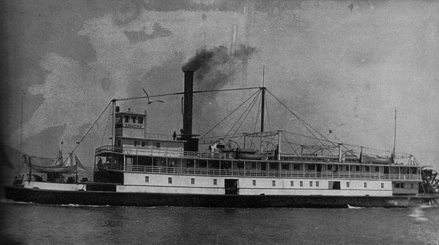
We were in a car of course, but I admit to a romantic yearning to travel the rivers of California by steam someday, as it was in the 19th century.
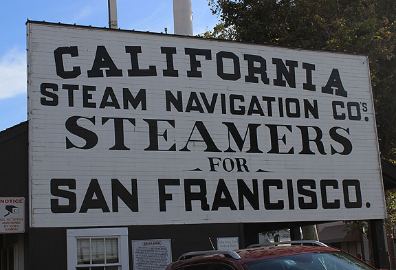
The sign is still there, why not the boat service?
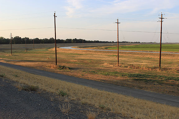
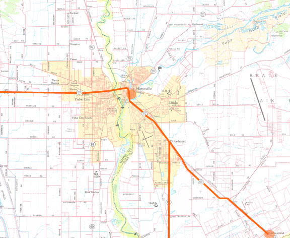
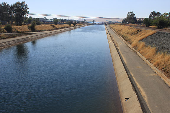
We didn’t linger too long in Sacramento, and headed north, with Marysville our evening end point. To get there we had to take Interstate-5 to get over the American River confluence with the Sacramento River, but quickly exited to ride the levees northward along the Garden Highway.
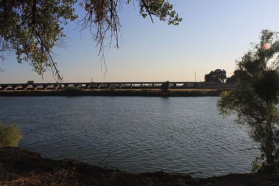
This is an impressive bit of hydrological engineering, the Sacramento Bypass, seen here from the Garden Highway on the opposite bank’s levee, the Sacramento River running very low in this extreme drought.
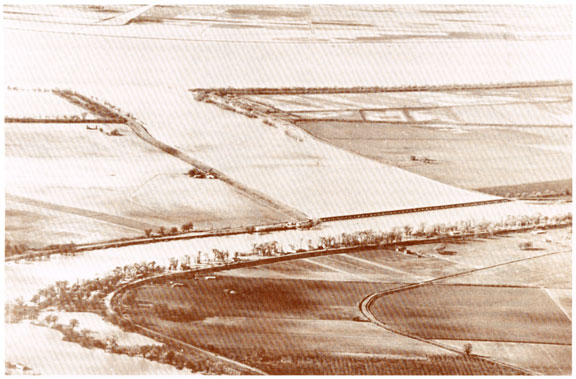
In this U.S. Army Corps of Engineers photo you can really appreciate the function of the Sacramento Bypass (the small-looking bridge across the mouth of the wide channel going diagonally up and to the left), which allows flood stage waters to divert across into the Yolo Basin in a deliberate and controlled manner. (Garden Highway running under trees on levee at edge of river.)
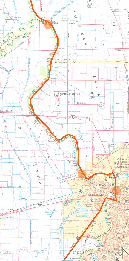
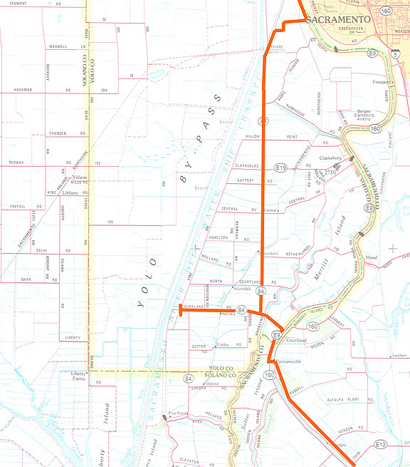
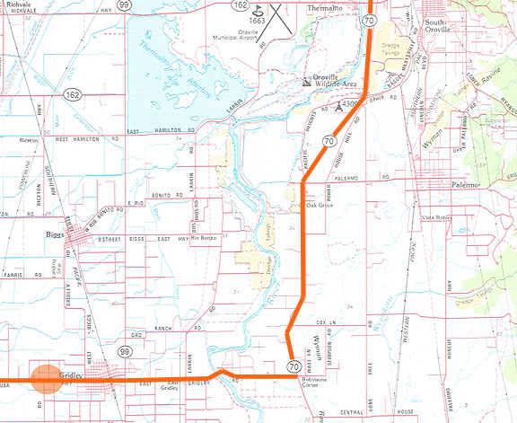
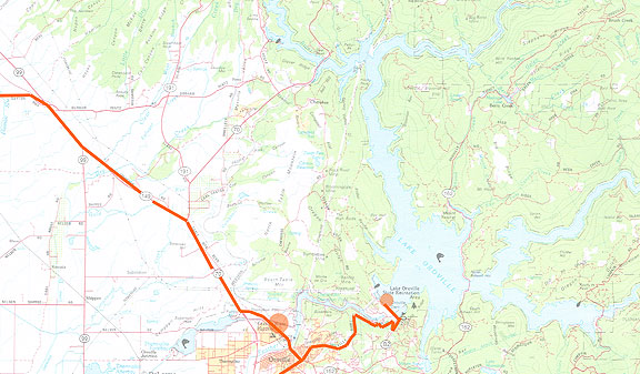
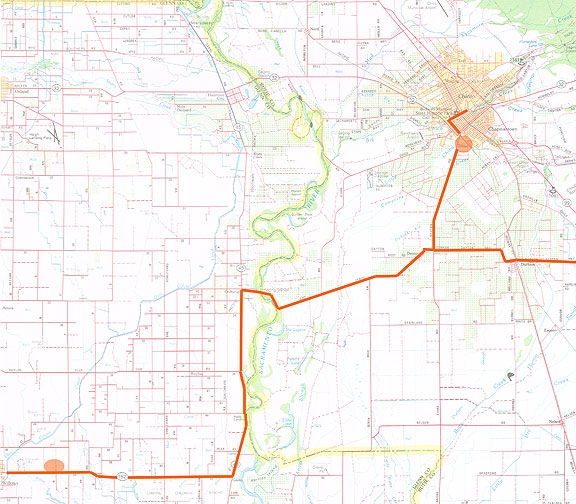
This map shows our route along the Garden Highway, with spots at Old Sacramento and the Sacramento Bypass and Joe’s Landing.
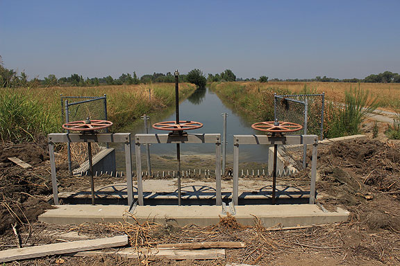
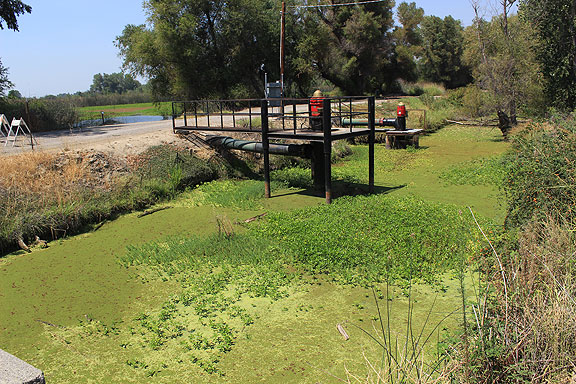
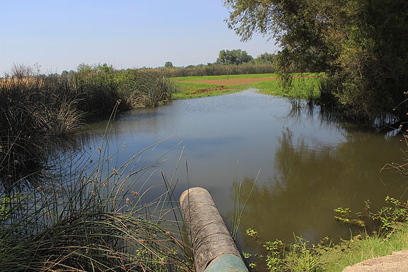
This is the Cross Canala from Joe’s Landing at the bend in the Sacramento River just before its junction with the Feather River.
A view of the intake machinery where the Cross Canal begins just across the levee from the Sacramento River.
We made it to Marysville at dusk, having a bite at the old Silver Dollar Saloon. Before that we climbed the levee and joined some camping people who were about to set up for the evening in the broad, dusty flood plain of the Yuba River. The Yuba is running really low too, like most rivers now. The next day I took photos of the abandoned and boarded-up Hotel Marysville (just waiting for artists to come and start the gentrification of Marysville!), and the arches that grace their D Street, very reminiscent of the arches that once stood over intersections along Fillmore during the 1915 Panama-Pacific International Exposition in San Francisco, but were torn down in 1943 to be used for bomb-making materiel.
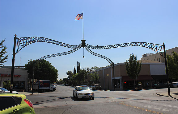
Marysville’s Historic Arches!
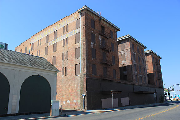
Hotel Marysville
The next morning I was determined to make a side trip to Wheatland, site of the 1913 IWW Hop Riot, which led to several deaths and actually spurred IWW organizing throughout California as they gained some serious notoriety from it. Wheatland is quite a depressed community today, but it still straddles the old Southern Pacific tracks, and its tiny center has an old combo Grange Hall/Odd Fellows Building, next to which sits what I guess might have been City Hall once upon a time. (Apparently Wheatland is in some kind of negotiation—or perhaps it’s been settled—to take millions of cubic tons of San Francisco garbage for its landfill.)
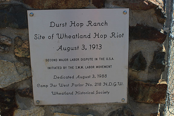
A small monument was our grail.
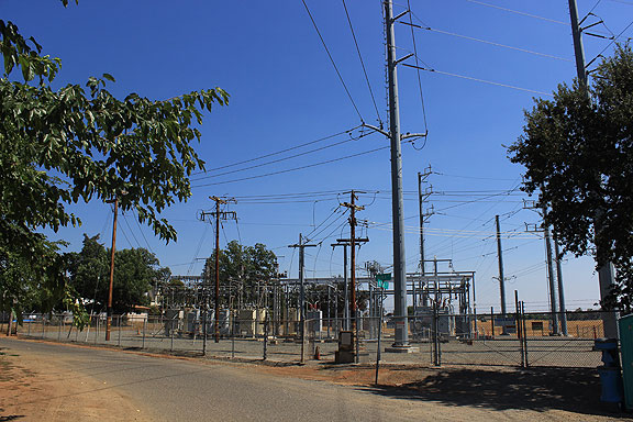
It’s at the edge of the small town in a tiny crevice of this power substation, which was once the Durst Hop Ranch.
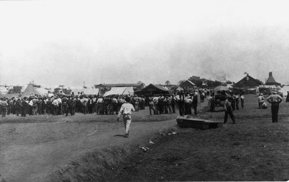
Strikers plan their action at Wheatland in 1913.
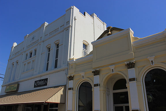
Wheatland’s Grange Hall (and Odd Fellows Building) with the yellow building sporting some ornate decorations, all wheat-inspired.
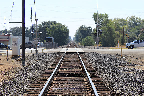
The railroad tracks that once carried hobos and bindlestiffs from migrant labor camp to small town free speech fight in the 1910s.
First we backtracked southeast to Wheatland, then headed northwest back through Marysville, to Route 20 west.
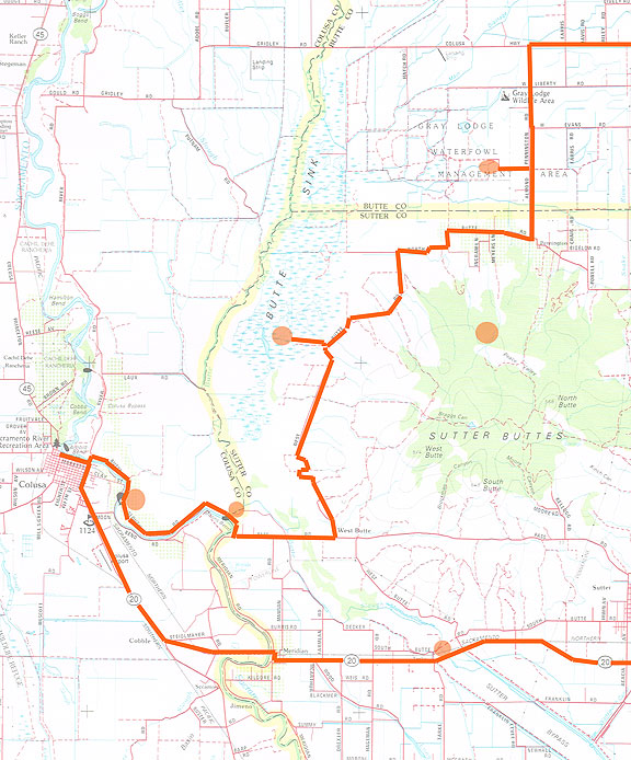
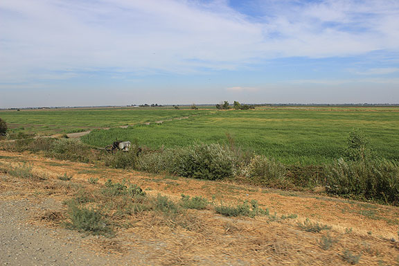
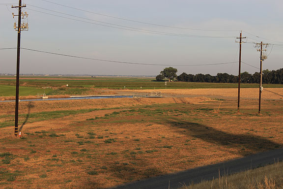
West on 20 we made our way quickly to Colusa, and then we meandered for several hours along Butte Road, in the shadow of the magnificent Sutter Buttes (orange spot). We took a short jog into the heart of the Butte Sink only to find a very parched, utterly dried up swamp. The circles are in the middle of the Sutter Bypass along Highway 20, at the juncture of Butte Slough and the Sacramento River, in the Butte Sink. and the Gray Lodge managed wetlands.
Sutter Bypass with old railroad bridge crossing it, Sutter Buttes to north in background, taken from Hwy 20.
Close-up of same view.
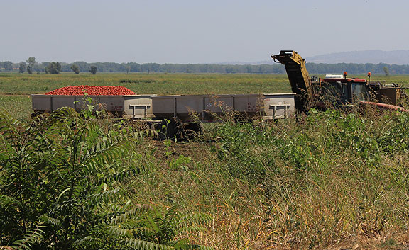
Tomato harvest alongside Sacramento River southeast of Colusa.
You can see the depth of the tomato fields next to the levee in this image.
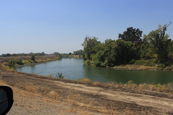
Sacramento River west of Sutter Buttes, south of Colusa.
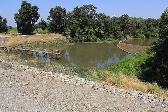
Butte Slough at Moon’s Bend, southeast of Colusa.
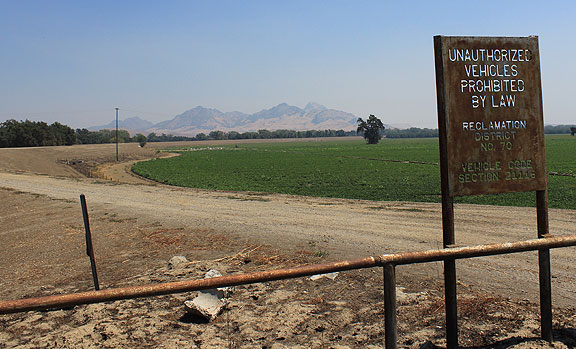
Sign for an old Reclamation District near Butte Slough.
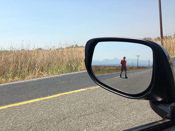
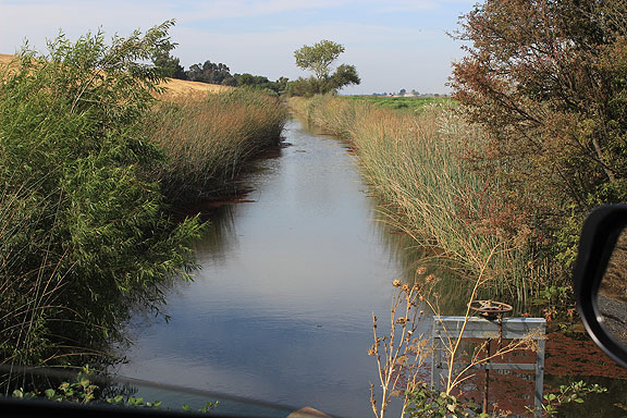
I had to keep jumping out of the car to take photos of various ditches and pumps!
Another abandoned railroad crossing over the Sutter Bypass, near Sutter Buttes.
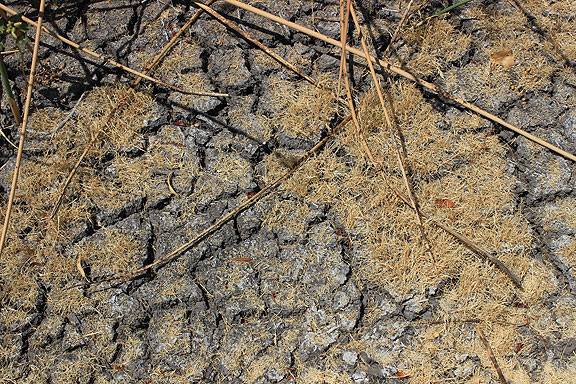
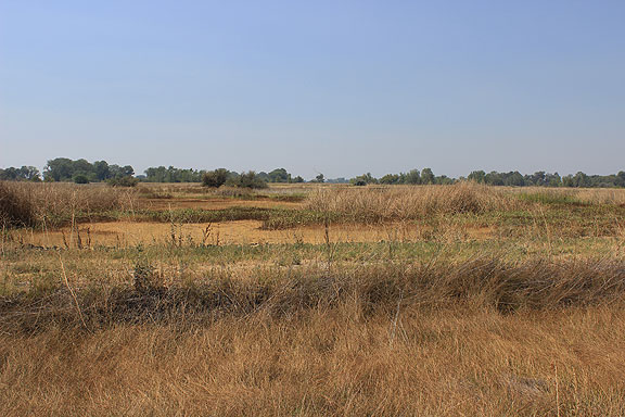
Here we are deep into the Butte Sink, which I presume is usually more like a vast swamp than this caked, dry tinderbox.
Butte Sink.
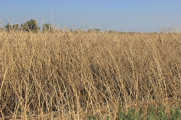
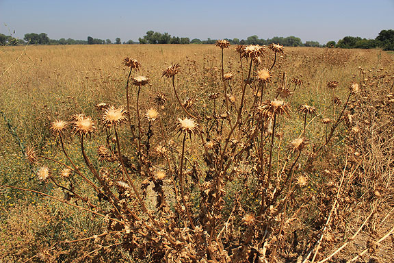
Completely dried tule fields in Butte Sink.
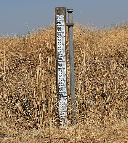
Coming back out of the Butte Sink we came upon this water level gauge, with nothing to measure at the moment!
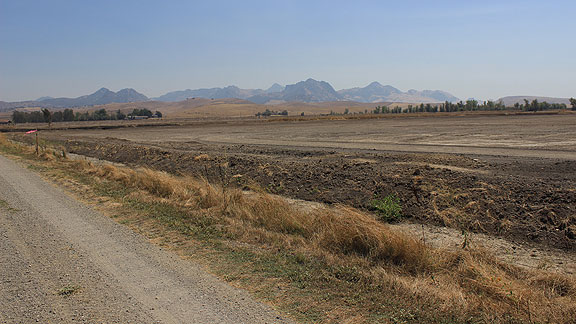
Dry dirt field at edge of Butte Sink with Sutter Buttes in distance to southwest.
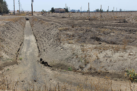
This is the same farmer’s field nearer to Butte Road, with bone dry irrigation canals, and a pump and drip irrigation with nothing happening in the drought.
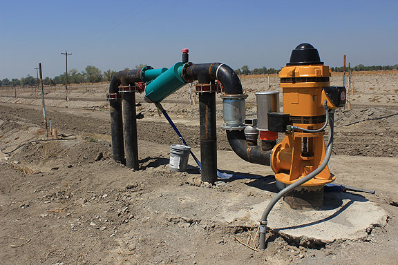
This pump is surely meant to tap the aquifer, but given the desolate surroundings, is clearly not in use at this time. Don’t know if it’s because the water table has fallen too far in the drought, or if it was for some other reason.
Aquifer pumps in almond orchard, keeping the California almond crop coming…
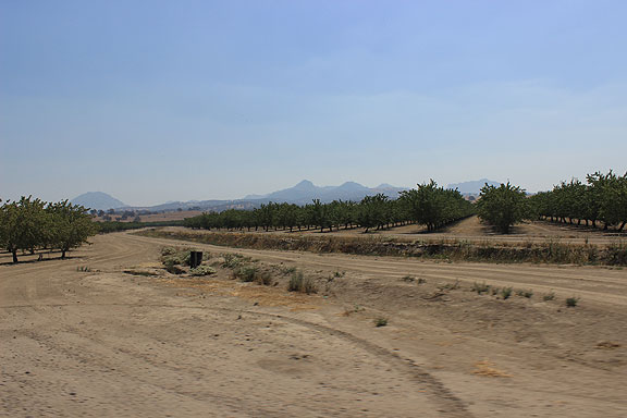
Dry orchards north of Sutter Buttes.
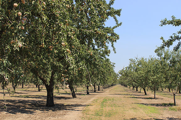
Closer look at an almond orchard.
Driving north on Almond Pennington Road we wanted to see the Gray Lodge Waterfowl Management Area. Here’s a view across the open fields of the very dry wetlands.
Large area of the Gray Lodge Area are dry as hell.
But they are consciously trying to preserve an important stop on the Pacific Flyway, and know that after all the water projects in the state, they are obliged to manage the water supplies for the wetlands too.
Here’s an algae-covered pond supplying water for the wetlands on the other side of the levee (next two photos).
Gray Lodge managed wetland.
This is what relatively healthy tule reeds look like, maintained at Gray Lodge.
We headed to Gridley and on to the road north to see the Oroville Dam.
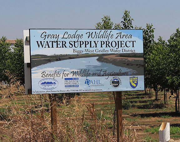
Just west of Gridley we came upon this canal and explanatory sign.
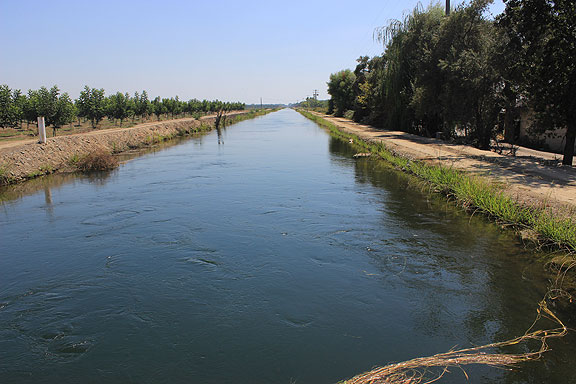
Biggs-West Gridley Water District Canal.
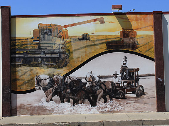
A telling mural on the wall in Gridley, memories of the old days of uncontrollable flooding.
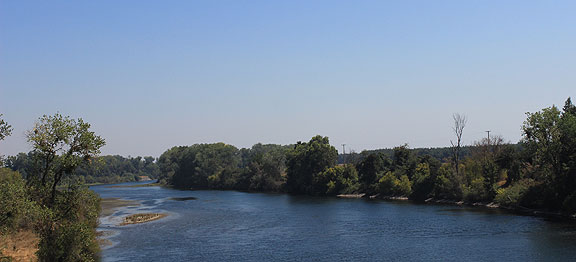
We crossed the Feather River again east of Gridley.
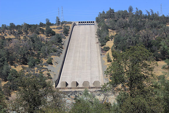
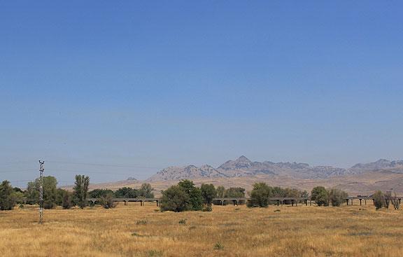
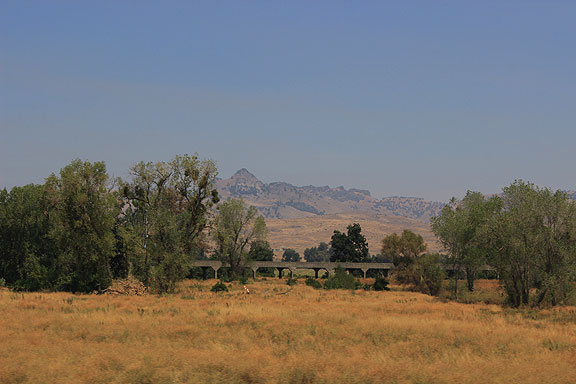
Clmbing up to the Oroville Dam, this spillway is the first obvious piece you see.
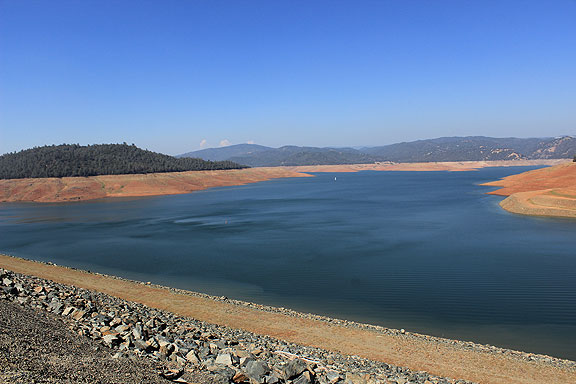
Lake Oroville, darned low!
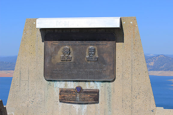
A memorial to the engineers!
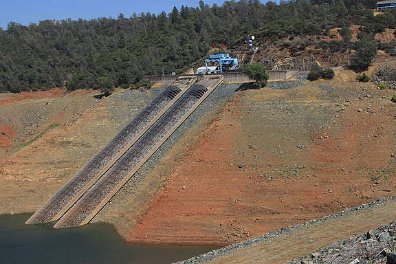
Pumps I guess… probably not too often having to cross so much bare ground to reach the water.
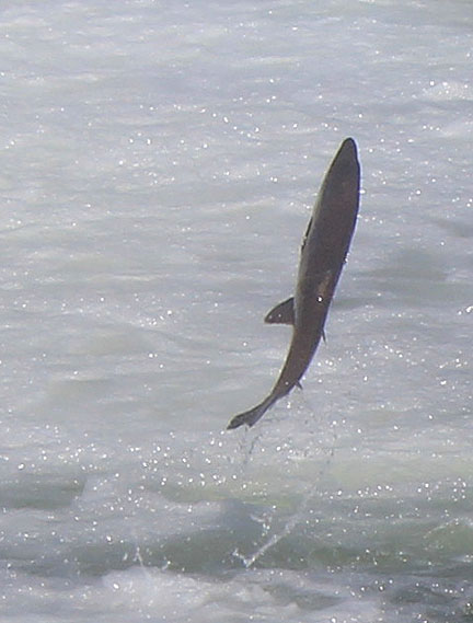
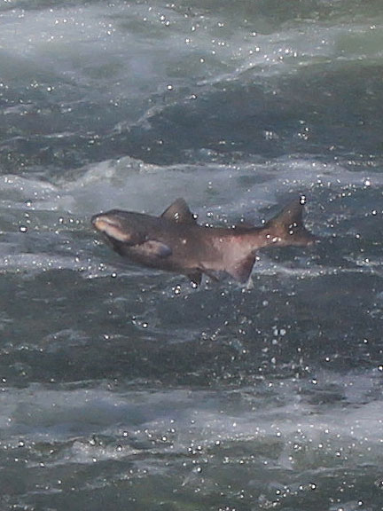
From Lake Oroville we headed to our friends’ home just south of Chico, stopping at the Feather River Fish Hatchery on the way.
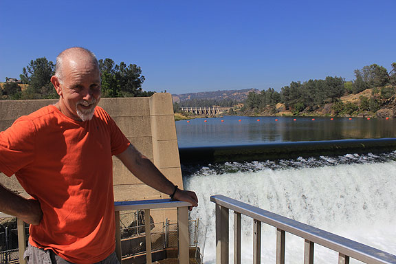
At the Fish Hatchery!
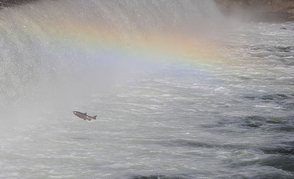
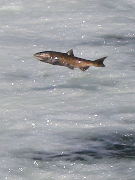
Incredibly we saw dozens of salmon making the heroic if hopeless effort to jump up the dam.
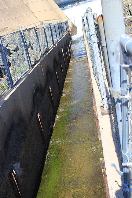
Fish hatchery diversion channel, where they push the salmon to “milk” them of their eggs, but here it is dry.
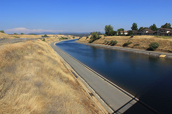
The Thermolito Forebay Diversion, downstream from the Fish Hatchery, using water from Lake Oroville.
West on the Diversion.
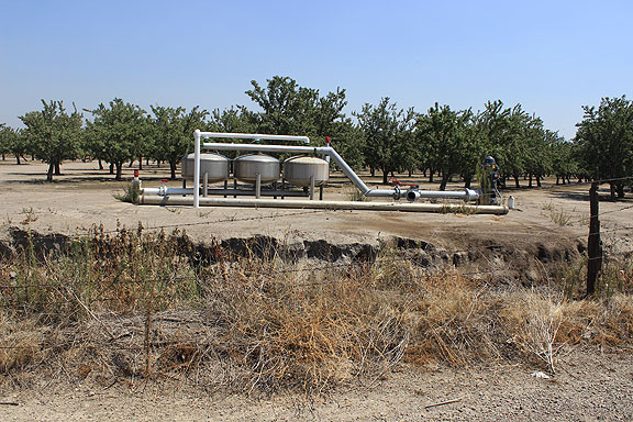
We arrived at our friends’ home in Chico, an old ranch house amidst walnut and almond orchards. They are having some locals use their land to grow food for a local CSA. Jesse showed me his old pump (80 feet) and his new one (200 feet), and we dropped a pebble into the old one, but heard no water.
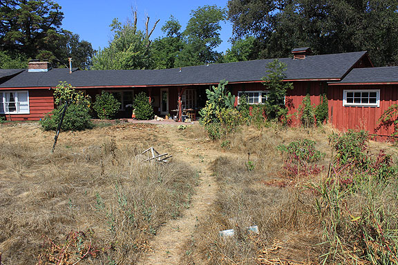
Our friends’ home in Chico, also in the midst of severe drought.
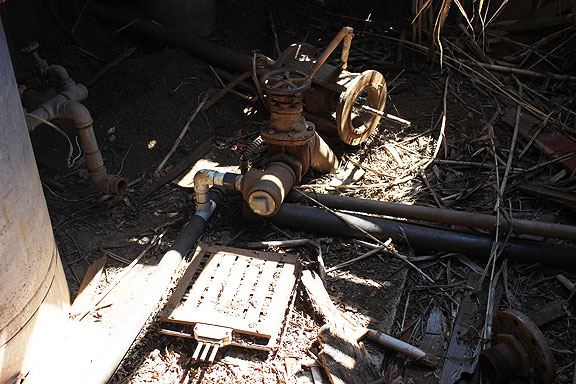
The old 80 foot pump, now bone dry.
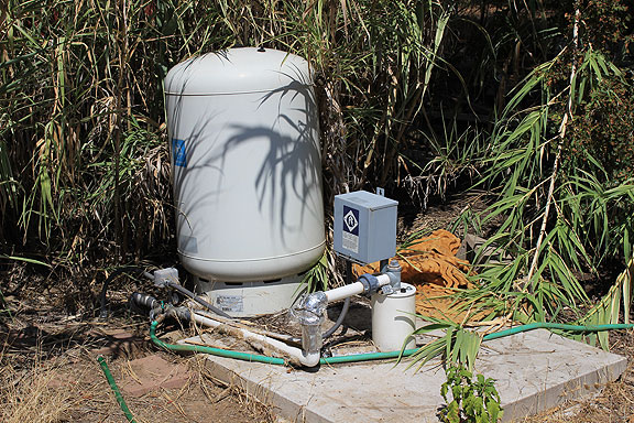
The new pump, 200 feet deep, still producing good potable water.
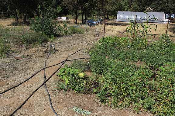
Small garden plot at their house with irrigation running everywhere.
Plenty of water being used to grow rice along Highway 162, which we saw in abundance on our way back to San Francisco.
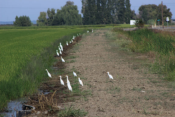
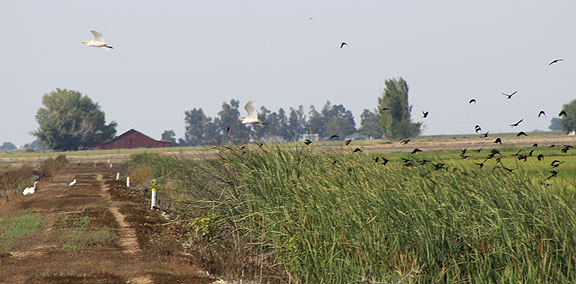
These egrets sat like sentries along the rice fields, looking for?… frogs?
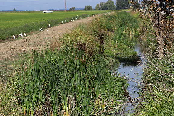
Water in crazy abundance in the rice fields.
We decided to return after the winter rains to see the millions of birds in the Gray Area Waterfowl Area…
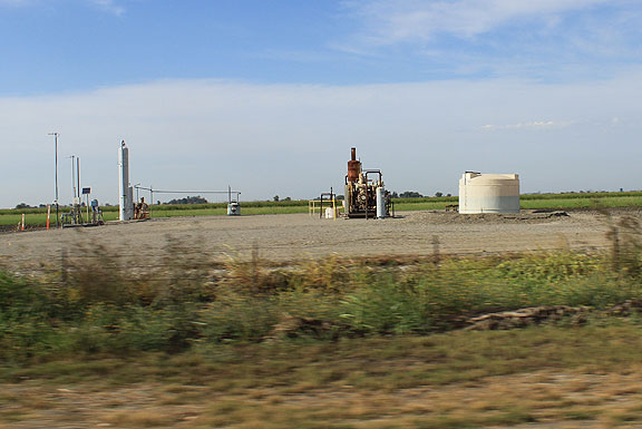
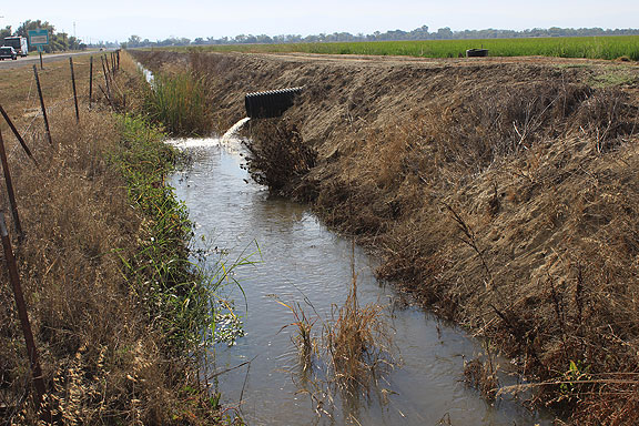
Pumps everywhere tapping the aquifer for the rice fields.
And to think it’s all thanks to this ungainly device that the waterways in California are somewhat managed…. at least in the Delta and Bay.
last leg of our trip before I-5 home…
Click on this to get the full size version of this handy map of how water is used in California.
This great map is borrowed from the excellent Atlas of California by my pal Dick Walker and Suresh K. Lodha.


Nice pictures and a good overall delta experience… a couple of other good books are Sacramento, River of gold and California paddle wheel days. I also like your tall bike… did you make it?
Also the pic you stated “Pumps everywhere tapping the aquifer for the rice fields” That’s a gas well I know I work on drilling rigs that drilled a lot of them in 1970’s. really like you’re pics brought back memories.
Ed
Gridley, CA.
The 2 bridges going over the sutter bypass you showed were not railroad bridges. The one you can see from hwy 20 is called “Longbridge” the other with the graffiti is named “Mawson bridge”. On hwy 20 going towards Yuba City on the left side of the bridge you will see a concrete abutment painted green with graffiti on it that says Jesus saves or something close to that was where the railroad bridge was but burned to a crisp in the 1970’s
Chris, this is so interesting! Thanks for posting. I got to your page from the cool drone video you posted on Facebook.I’ve been writing a bit too about watersheds, mostly in a travel blog because that’s a focus of our travels around California: travelswithmoho.wordpress.com.
BTW, I have no desire to return to your desert.
I find the light and air of the east so much more comforting.
The last time I was out west for a significant period of time (summer of 1976 in Denver), I was appalled upon return to the east by the humidity and air pollution.
Now, almost 40 years later, it is just the opposite – I was pleased to return and noticed a stunning difference in the light.
The eastern moisture and clouds give the light a completely different feel – really huge, and comforting.
The dry western desert has a harshness, edge, and solar intensity that is hard to tolerate.
Great post!
I was just out in California last week – crossed the central valley 4 times over 4 different routes going to Yosemite and Sequoia. Saw Salinas, Monterey, Big Sur and a little of Marin. Was focused on the water and drought issues as well.
Stopped in SF for 1 day only. Awfully tourist town, no? Could not stand the cold windy fog conditions. Wanted to look at the murals at Coit Tower and was frustrated by the tourist hordes, who could have cared less about them. Like trying to get to the roof of the museum to take a picture of the skyline.
Essential reading of the history of water is Cadillac Desert and the 6 part documentary.
Here are some of my photos:
http://www.wolfenotes.com/